search
search

Himlung Himal Expedition

globe_location_pin

Country

Nepal

calendar_clock

Duration

29 Days

avg_pace

Difficulty

Strenuous
partly_cloudy_day

Best Season

Oct, Nov, Dec, Feb, Mar, Apr, May

conversion_path

Start / End Point

Kathmandu/ Kathmandu 

landscape_2

Max. Altitude

7,126m 

landscape

Nature Of Trek

Teahouse trekking + climbing

footprint

Activity

Expedition

directions_walk

Trek Duration

4-6 hours

elevation

Climbing Period

5-7 hours

fork_right

Climbing Route

Northwest ridge

location_on

Region

Manaslu Region

groups

Group Size

2 - 20

code_blocks

Trip Code

HE9

hiking

Activity Per Day

5-7 hours

home

Accommodation

Teahouses + Camping
flatware

Meals Included

Breakfast, Lunch, Dinner
local_taxi

Transportation

Jeep

editor_choice

Recommended For

ntermediate climbers

Himlung Himal Expedition Highlights

  • Combine a high-altitude trek and a Himalayan expedition into one single adventure with Himlung Expedition.
  • Follow the remote, restricted trail through the Nar-Phu Valley to the summit of Himlung Himal (7,126m).
  • Trek from lush river valleys to alpine meadows, and cross icy slopes, glaciers, and climb rocks to reach the summit.
  • Get a chance to witness the diverse flora and fauna of the Annapurna Conservation Area.
  • Enjoy spectacular, sweeping views of Mount Annapurna, Manaslu, and Ganesh Himal ranges.
  • Observe beautiful sunrises and sunset views and enjoy stargazing under pristine skies from your high-altitude camps.
  • Capture surreal photographs of the diverse landscapes, glacier formations, charming villages, and terrace farms.
  • Trek past traditional settlements while experiencing ancient Bon and Tibetan Buddhism culture and customs.

Himlung Himal Expedition Overview

The Himlung Himal Expedition is an ultimate Himalayan adventure with a unique blend of raw adventure, mountaineering, and cultural discovery. Hidden in the remote Nar-Phu valley, close to the Tibetan border, the 7,000m peak stands tall at 7,126m. The Himlung Himal is a perfect high-altitude adventure for climbers who prefer an authentic expedition experience. 

Himlung is located in a unique crossroads between the Annapurna and Manaslu massifs. You will start the expedition with trekking along the classic Annapurna region trail. It then diverges to the less-traveled and restricted Nar-Phu valley. The valley was opened to outsiders only in 2002. Hence, the area is largely unexplored and untouched by mass tourism. You will follow the off-the-beaten trail through age-old settlements like Koto and Phu-Gaon. These settlements offer a rare glimpse into the ancient Bon and Tibetan Buddhism. The Himlung Himal Expedition trail also passes by ancient monasteries, mani walls, and prayer wheels. It is a spiritually and culturally immersive experience.

Following the trail, you will ascend to the high camps and push to the summit of Himlung Himal. It offers a strategically designed 7,000m mountaineering experience. Unlike other peaks with similar altitude, you will climb only three high camps and make a short summit push of around 8 to 10 hours from Camp III. This gradual progression reduces the exposure to high altitude and minimizes the risk. The Himlung Himal Expedition route follows the Northwest Ridge. It involves glacier travel, crevasse navigation, and climbing snow slopes of 35-50 degrees. Himlung is a moderately technical peak and is suitable for mountaineers progressing from 6,000m mountains.

The Himlung Himal Expedition offers remoteness, adventure, and safety. Hence, it has a relatively higher summit success rate. With a well-curated itinerary, well-planned acclimatization, and the help of experienced guides from a reliable operator, the expedition is an adventure of a lifetime. Throughout the journey, each day will unfold thrilling high-altitude trekking, cultural encounters, and mesmerizing views of Annapurna, Manaslu, Ganesh Himal, and more. Then, standing on top of the peak, you will be rewarded with a huge sense of achievement, surrounded by towering Himalayas. It is an unforgettable moment that will leave a lasting impression. 

The Himlung Himal Expedition is not only about summiting the peak, but also a journey of self-discovery and resilience. Far from crowds and commercialization, it is an immersive adventure into the untouched wilderness of the Himalayas. Experience the pristine beauty of the Himalayas with Snow View Trek’s Himlung Himal Expedition!

Himlung Himal Expedition Detailed Itinerary 

Day 01 :

Arrival in Kathmandu (1,324m), transfer to the hotel

On this day, you will arrive in Nepal and land at Tribhuvan International Airport, Kathmandu. Upon landing, you need to pass through immigration and get your on-arrival visa. After completing all procedures, head to the terminal exit. Our Snow View Trek representative will be waiting for you. They will greet you and assist you with your transfer to your hotel.

Check into your hotel and freshen up. Since it is your first day in Nepal, you can unpack, settle in, and relax. Then, you can also explore around the hotel area and soak in the atmosphere. You will receive the briefing for your Himlung Himal Expedition tomorrow. So, you can spend your time leisurely today.

Day 02 :

Rest, preparation, and briefing day in Kathmandu (1,324m)

Day 2 is all about resting, preparing, organizing, and gearing up for the Himlung Himal Expedition. You will have breakfast at the hotel and start your expedition preparation. From checking your clothing to gear and mountaineering equipment, our guides and staff will inspect them to ensure everything is in perfect condition. If anything is missing or needs replacement, they will provide guidance on where and how to obtain it.

There will also be a comprehensive Himlung expedition briefing. The guide will provide a briefing on the Himlung Expedition route, daily trekking/climbing duration, altitude-acclimatization schedules, and safety procedures. Similarly, they will provide a briefing on altitude sickness prevention, emergency protocols, and communication methods. If you have any doubts or questions, you can ask your guide. In the evening, you can explore around or rest at your hotel. Tomorrow marks the actual start of the Himlung Himal Expedition.

Day 03 :

Drive from Kathmandu (1,324m) to Koto (2,600m)

road

Drive Distance

220km

departure_board

Drive Duration

8-10 hours

home_pin

Place

Koto

The day begins early, and you will board a vehicle for a full-day drive. You will drive through the silent streets of Kathmandu and gradually leave the city behind. The vehicle drives on the Araniko Highway, passing by the bustling towns of Dhulikhel and Banepa. The route gradually opens up into terrace fields and rolling green hills. You will follow the Trishuli River Valley and head north. Driving on the narrow winding roads carved into the sides of a steep hillside, you will cross suspension bridges. The vehicle also passes through riverside villages such as Trishuli Bazaar and Muglin. These small settlements offer your first glimpse at the rural countryside and village life of Nepal.

After driving for some time, the scenery changes from green farmlands to dense forests. The road also gets more rugged and bumpy after leaving the highway. The mountain road is rough but thrilling. You will drive past landslide-prone areas with sharp cliff drops on one side. From here onwards, you will also start seeing snow-capped peaks at a distance. Along the way, you will pass by the villages of Dharapani and Barga with simple stone houses and colorful prayer flags. It will be late afternoon when you arrive in Koto.

The Koto village is the gateway to the Nar-Phu region. It is a quiet mountain village surrounded by remote Himalayan landscapes. It will build your anticipation for the upcoming expedition. You will rest overnight at Koto.

Day 04 :

Trek from Koto (2,600m) to Mehta (3,200m)

directions_walk

Trek Distance

13km

av_timer

Trek Duration

5-6 hours

home_pin

Place

Mehta

Day 4 marks your first day on the Himlung Expedition trail. From Koto, the trekking trail follows a narrow path along the Budhi Gandaki River. It starts with a gentle walk through traditional riverine settlements with stone houses and terraced farms. As you pass by these settlements, you will get a glimpse of the locals in the Nar-Phu region. After a while, the trail gradually ascends through the forests of rhododendron and pine.

Trekking under the cool shade of the trees and breathing in the fresh mountain air is truly refreshing. Then, you will ascend over rocky, rugged terrain, while occasionally crossing the small streams over wooden bridges. There are numerous colorful prayer flags, mani walls, and chortens along the route. It offers a glimpse at the influence of Tibetan Buddhism in the region. Halfway along the trail, the trek becomes steeper. You will start trekking through narrow valleys, and you can see towering cliffs and distant mountain peaks.

Similarly, you will come across several waterfalls. The trail gradually opens into the Mehta region, where you will reach around late afternoon. Mehta is a small high-altitude settlement surrounded by alpine pastures. There are small basic teahouses and lodges in the area, and you will stay here for the night. While resting at Mehta, you can soak in the tranquil atmosphere. Likewise, enjoy spectacular, panoramic views of the surrounding ridges and distant Himlung Himal peaks.

Day 05 :

Trek from Mehta (3,200m) to Phu-Gaon (4,400m)

directions_walk

Trek Distance

16km

av_timer

Trek Duration

7-8 hours

home_pin

Place

Phu-Gaon

You will start the day with a hearty breakfast at Mehta. Today’s trek will be your first major altitude gain, and you will head deeper into the Nar-Phu valley. The Himlung Himal Expedition trail takes you through green pastures and open alpine meadows. Sometimes you may come across grazing yaks on the pastures. You will come across traditional stone shelters used by local herders. As you continue trekking forward, the landscape becomes more rocky and rugged.

The vegetation also becomes sparse, with very few trees at higher elevations. After a while, the trail gradually ascends along the Budhi Gandaki tributaries. You will trek along a winding trail through narrow valleys, past sheer cliffs, and occasional waterfalls. Trekking on the rocky terrain and high altitude is challenging and requires careful footing. There are also loose scree sections near the riverbanks. The area also becomes more isolated.

Along the way, there are only small settlements and chortens. As you get closer to Phu-Gaon, the valley becomes narrower. You will find yourself in a high-altitude environment, surrounded by snow-capped peaks. The Phu-Gaon is a small settlement with stone-built teahouses, where you will take your first acclimatization day.

Day 06 :

Rest & acclimatization day at Phu-Gaon

Today, you will take a full rest and acclimatization day at Phu-Gaon. It is a crucial stop before you ascend to a higher altitude. Taking a rest day allows your body to adapt to the higher elevation and reduce the risk of altitude sickness. It also allows your body to recover before the more demanding trek and climb ahead.

After breakfast, you will explore the Phu-Gaon village and the local culture. You will have the opportunity to observe local life and interact with local families. There are small monasteries, mani walls, and chortens around the village. In addition to cultural interactions, you may also take short hikes to nearby viewpoints.

From these viewpoints, you can enjoy sweeping views of the snow-capped mountains, valleys, and glaciers. Rather than challenging or exhausting hikes, these are short acclimatization walks. These help you in breathing exercises and hydration routines. In the evening, you can rest and enjoy the view.

Day 07 :

Trek from Phu-Gaon to Himlung Base Camp (4,850m), Camping Setup.

directions_walk

Trek Distance

12km

av_timer

Trek Duration

5-6 hours

home_pin

Place

Himlung Base Camp

After the acclimatization day at Phu-Gaon, you will resume your Himlung Himal Expedition. You will leave Phu-Gaon, the last permanent settlement before the Himlung Base Camp. The trail follows a wide glacial valley shaped by ancient Himalayan ice flows. Similarly, the terrain becomes more rugged, and the landscape turns dry and windswept. You will also navigate your way on loose rocks, moraine ridges, and occasional ice patches. As altitude increases, the air becomes thinner, making the ascent more demanding. It is important to maintain a slow, steady pace and stay hydrated.

The route opens up into a vast high-altitude basin. Great snow-capped mountains surround you from all sides, and the sheer size of the Himlung Himal becomes more awe-inspiring. You can also see the snow-covered ridgelines and hanging glaciers. As you get closer to the Himlung Base Camp, you must cross glacial moraines and rocky terrains. It requires careful navigation and footing. Likewise, the area becomes increasingly silent and isolated. The only sound you will hear is the wind and shifting ice at a distance. When you finally reach the Himlung Base Camp, the trek becomes a mountaineering expedition.

With your Sherpa guide and support team, you will set up your tent. You will help maintain a well-organized campsite and assist with sorting or checking climbing gear. The guide will provide a short briefing on the climbing strategy, route conditions, and safety protocols. Watch the sunset from the Base Camp and enjoy stargazing at night.

Day 08-22 :

Climbing Period for Himlung Himal Summit (7,126m)

Days 8 to 22 are reserved for the Himlung Himal climbing phase. It includes high-altitude climbs, acclimatization, and summit attempts. From the base camp, you will follow a rotation system, which includes ascending to higher camps and descending back to recover. This rotation system allows your body to adapt to extreme altitude while carrying mountaineering gear. The route to the summit of Himlung Himal goes from the base camp to Camp I (~5,400m), Camp II (~6,000m), and Camp III (~6,400m).

The route to the summit of Himlung takes you through glaciers, snow slopes, and exposed ridgelines. You will navigate crevassed glaciers, icy sections, and steep snow slopes using fixed ropes. Additionally, you will have to use basic mountaineering skills to overcome these obstacles. With each rotation, you will gain more confidence, and your body will get used to the high elevation. Depending on the weather conditions, you may have to spend a few days waiting at Base Camp. You will only make a climb to the summit when the weather conditions are the most stable and clear.

On the day of the summit, you will start early in the morning from the highest camp, usually between 1:00 AM. You will navigate the route to the summit on icy slopes and exposed sections in thin air. The climb is long and physically strenuous. Finally, you will reach the summit of Himlung Himal (7,126m). Stunning views of Annapurna II, Annapurna III, Gangapurna, Manaslu, Tilicho Peak, and Gyaji Kang will greet you. A huge sense of awe and achievement washes over you. Similarly, the vast witness before you offers a moment of quiet reflection and allows you to connect with the Himalayas. After completing the summit, you will descend back to the lower camps. The remaining days are set as buffer time for weather delays.

Day 23 :

Preparation, Packing, and Ready to return, Overnight Camp.

Today, you will prepare for your return to Himlung Base Camp. You and the team will pack up the camp setup and personal gear. The Sherpa guide and support staff will coordinate the sorting and loading of equipment for descent into the valley. Compared to the prior summit days, today is a relatively relaxing day. You will retrace your steps to the Himlung Base Camp, where you will stay overnight. You can reflect on your expedition and the entire experience with the team. Your climbing phase concludes here, and your return trek begins.

Day 24 :

Trek from Himlung Base Camp (4,850m) to Phu-Gaon (4,400m)

directions_walk

Trek Distance

6km

av_timer

Trek Duration

3-4 hours

home_pin

Place

Phu-Gaon

After breakfast, you will descend from Himlung Base Camp and retrace your steps to Phu-Gaon. The return Himlung Himal Expedition trail takes you through the familiar paths, across the same glacial basin and moraine terrain. You still have to navigate carefully, but you will be climbing to a lower altitude, which makes breathing easier. It is also physically less demanding than ascending. Once again, the route takes you past glacial streams, rocky ridges, alpine valleys, and green pastures. Upon reaching the Phu-Gaon, familiar landscapes and stone houses will greet you. You will rest and recover from expedition fatigue here tonight.

Day 25 :

Trek from Phu-Gaon (4,400m) to Mehta (3,200m)

directions_walk

Trek Distance

16km

av_timer

Trek Duration

6-7 hours

home_pin

Place

Mehta

You will continue to descend through the Nar-Phu Valley today. From Phu-Gaon, you will climb downhill toward Mehta. The trail takes you through familiar, narrow valleys and along riverbanks, over rough, rugged terrain. Similarly, you will pass by stone shelters, mani walls, prayer flags, and mani walls. As you continue descending, you will notice a shift in the landscapes.

It changes from dry alpine terrain to greener areas with patches of vegetation. Then, you will trek through forest areas while passing by small streams. The walking pace also becomes more relaxed than in the earlier days. You will stay overnight in Mehta. Rest comfortably and enjoy the surrounding views and serene atmosphere.

Day 26 :

Trek from Mehta (3,200m) to Koto (2,600m)

directions_walk

Trek Distance

13km

av_timer

Trek Duration

5-6 hours

home_pin

Place

Koto

The downhill trek continues on this day as well. Today is the final descent on the Himlung Himal Expedition itinerary, where you will exit the Nar-Phu valley. The trail goes through forests of rhododendron and pine. You will cross the same wooden bridges that you crossed before and trek on the narrow forest paths. The lower elevation and the surrounding lush vegetation make the journey enjoyable.

Similarly, you will trek past mani walls and chortens. As you approach Koto, the traditional houses and green terrace farms slowly come into your view. You will spend the night at a teahouse in Koto. Enjoy the quiet surroundings and the views to your heart’s content as your trekking and climbing adventure comes to an end.

Day 27 :

Drive from Koto (2,600m) to Besisahar to Kathmandu (1,324m), transfer to the hotel

directions_walk

Trek Distance

220km

av_timer

Trek Duration

8-10 hours

home_pin

Place

Kathmandu

Today, you will board a vehicle early in the morning and begin your long return journey to Kathmandu. The vehicle drives on the rugged mountain road, passing through the villages of Dharapani and Chamje. Similarly, you will pass by the familiar waterfalls, river gorges, and terrace farms. From Besisahar, the bumpy road connects with the highway, where it becomes relatively smoother.

The vehicle will drive along the Marshyangdi and Trishuli river valleys. Passing through small towns and villages, you will get one last look at the rural countryside of Nepal. The road starts to get busier as you get closer to the Kathmandu valley. Upon reaching the capital city, the vehicle will transfer you to your hotel. You can rest and stay comfortably in your hotel in Kathmandu.

Day 28 :

Debriefing, Leisure Day, Farewell Dinner in the Evening

This day is for you to relax, rest, and recover after the Himlung Himal Expedition. You can explore around the city, local markets, or cultural sites. If you need, we can also arrange a Kathmandu sightseeing tour for you. The tour covers visits to UNESCO World Heritage sites such as Pasupatinath, Boudhanath, Swayambhunath, and Kathmandu Durbar Square.

In the evening, we will hold a debriefing session and farewell dinner. During the session, you can share with us your climbing experience and provide feedback. We will also celebrate the successful expedition to the summit of Himlung Himal. You can share your most memorable moments and stories over traditional Nepali cuisine. With this, your Himlung Himal Expedition journey concludes.

Day 29 :

Transfer to the airport for the final departure

It is your final day in Nepal. Our representative will assist you with your transfer to Tribhuvan International Airport two to three hours before your flight. We hope you will have a safe flight back to your home country. Thank you for choosing Snow View Trek for your journey to Himlung Himal. We look forward to welcoming you back for future Himalayan adventures.

Cost Includes

Accommodation & Transfers:

  • Airport Transfers: Hassle-free pick-up and drop-off services for international and domestic flights.
  • Kathmandu Stay: 4 nights hotel accommodation in Kathmandu (Bed & Breakfast basis).
  • Trek Accommodation: Clean and comfortable tea house/lodge accommodation during the trek.

Permits & Documentation:

  • Climbing Royalty: Full Mt. Himlung expedition climbing permit fees paid to the Department of Tourism.
  • Regional Permits: Nar Phu Valley Restricted Area Permit and Annapurna Conservation Area Project (ACAP) entry fees.
  • Trekking Permits: Trekkers’ Information Management Systems (TIMS) card.
  • Liaison Officer: All costs for a government-appointed Liaison Officer, including salary, equipment, and insurance.

Professional Climbing Support:

  • Expert Leadership: Government-licensed, high-altitude Sherpa Climbing Guides with extensive expedition experience.
  • Ratios: 1 experienced Sherpa guide for every 2 climbers, plus an overall Expedition Leader.
  • Staff Welfare: Full wages, equipment allowances, and medical/accidental insurance for all staff (guides, cooks, and porters).
  • Emergency Coverage: High-altitude helicopter evacuation insurance for all staff.

Equipment & Logistics:

  • Base Camp Infrastructure: Personal high-quality tents at Base Camp; shared 2-person tents (The North Face or similar) at high camps.
  • Full Camp Setup: Dining, kitchen, storage, and toilet tents equipped with tables, chairs, and quality cooking utensils.
  • High-Altitude Gear: EPI gas, stoves, and high-quality dynamic/static ropes, ice screws, snow bars, and carabiners for route fixing.
  • Porterage: Up to 40kg of personal climbing luggage carried by porters or yaks to and from Base Camp.
  • Power: Solar panels and generators at Base Camp for lighting and charging laptops, cameras, and phones.

Oxygen & Safety:

  • Personal Oxygen: 2 bottles (4L each) of medical-grade oxygen per climber.
  • Top-tier Gear: Latest model Summit/Top-out masks and regulators provided for each member.
  • Emergency Backup: Extra emergency oxygen, masks, and regulators stored at high camps.
  • Medical Safety: Gamow bag (portable altitude chamber) and comprehensive group first aid/medical kits.

Meals & Nutrition:

  • Base Camp Dining: Three fresh, nutritious meals daily at Base Camp, prepared by professional expedition cooks.
  • Trek Meals: Full board (breakfast, lunch, dinner, and hot drinks) during the trekking phase.
  • High Altitude Food: Specially packaged high-energy meals and fuel are provided for all camps above Base Camp.
  • Refined Service: Dedicated Base Camp Manager and kitchen helpers to ensure hygiene and comfort.

Communication & Navigation:

  • Satellite Phone: Available for emergency and professional use (Personal calls: US$ 5 per minute).
  • Radio Comms: Walkie-talkies provided for constant communication between camps and guides.
  • Weather Reports: Daily professional weather forecasts sent from our Kathmandu office.

Cost excludes

  • Lunch and Dinner during your stay in Kathmandu (except farewell dinner).
  • Clothing, Packing Items or Bags, Personal Medical Kit, Personal Trekking Gears.
  • Any extra expenses arising out of various unforeseen situations like natural calamities, landslides, political disturbances, strikes, and changes in Government regulations.
  • Repatriation, Medicines, Medical Tests, and Hospitalization expenses.
  • Travel/medical/accidental Insurance and helicopter search-and-rescue evacuation.
  • Summit bonus to your climbing Sherpa (Required begins from a minimum USD 800 per summit per Sherpa)
  • Tips for base camp staff (Per member, beginning from a minimum of US$ 250.00 in total)
  • Repatriation, medicines, medical tests, and hospitalization expenses for members.
  • Travel insurance and helicopter rescue evacuation for members.
  • Other TIPS/Gifts/Souvenirs to anyone related to your expedition.

Departure

Private Trip

Prefer a more personal journey? Our private packages offer flexible dates, custom itineraries, and dedicated support—perfect for those seeking a tailored travel experience.

Additional Information

Himlung Himal Expedition Distance, Duration, and Altitude Summary

Take a look at the distance, duration, and altitude gain during the Himlung Himal Expedition:

Day Route/ Activity Distance (km/miles) Duration Altitude Gain/Loss
1 Arrival in Kathmandu
2 Rest, preparation, and briefing day in Kathmandu
3 Kathmandu – Koto 220km/ 136.7miles 8-10 hours (drive) Gain: 1,276m
4 Koto – Mehta 13 km/ 8.08miles 5-6 hours Gain: 600m
5 Mehta – Phu-Gaon 16km/ 9.94miles 7-8 hours Gain: 1,200m
6 Rest & acclimatization day
7 Phun-Gaon – Himlung Base Camp 12km/ 7.46miles 5-6 hours Gain: 450m
8-22 Climbing period for Himlung Himal Summit Gain: 2,276m
Loss: 2,276m
23 Preparation, packing, and ready to return, overnight camp
24 Base Camp – Phu-Gaon 12km/ 7.46miles 5-6 hours Loss: 450m
25 Phu-Gaon – Mehta 16km/ 9.94miles 6-7 hours Loss: 1,200m
26 Mehta – Koto 13 km/ 8.08miles 5-6 hours Loss: 600m
27 Drive from Koto – Besisahar – Kathmandu 220km/ 136.7miles 8-10 hours (drive) Loss: 1,276m
28 Debriefing and leisure day
29 Final departure

Where Exactly is Himlung Himal Located?

Himlung Himal is located in central Nepal, within the Ganesh Himal-Nar-Phu region. It is a remote Himalayan peak located on the border between the Manaslu and Annapurna regions. The Annapurna range lies to the east, while the summits of the Manaslu region lie to the west. The peak is a part of the Ganesh Himal of the Himalayas and stands at an altitude of 7,126m. Due to its remote location, Himlung is well known for its pristine wilderness and rugged terrain.

The expedition route to the Himlung Himal goes through the Nar-Phu valley. It is far from mass tourism and crowds compared to other popular 7,000m peaks in Nepal. The mountain is surrounded by alpine meadows, deep valleys, glacial moraines, and high-altitude pastures. Its remote location, raw wilderness, and moderately technical challenge make Himlung one of the most unique expedition experiences.

The Himlung Himal Expedition begins with a drive from Kathmandu to Koto. The small village of Koto acts as a gateway or starting point for the journey. You will follow the remote trail to Mehta, Phu-Gaon, and to Himlung Base Camp. During the trek, you will ascend and descend over varied terrain, including steep paths, cross rivers on wooden bridges, and pass through passes. The climbing route to the Himlung Himal starts from the base camp. It goes to Camp I, Camp II, and Camp III before pushing to the summit. The return route follows the same path you ascended.

Unlike other 7,000m peaks, very few climbers take the Himlung Himal Expedition. As a result, the entire experience is quiet and peaceful. Its moderate technicality makes it suitable for climbers looking to take on the 8,000m expedition. The route to the summit involves glacial travel and climbing icy, steep snow slopes. It is perfect for technical climbing practice. The challenging terrain and untouched wilderness make Himlung a perfect expedition for climbers seeking solitude, technical experience, and cultural encounters.

What Kind of Accommodation and Meals Are Available During the Himlung Expedition?

Accommodation and meals during the Himlung Expedition are basic. Your accommodation types differ between the trekking and climbing phases. Take a look:

During the Trekking Phase

The trekking phase spans from Koto to Phu-Gaon, during which you will stay at local teahouses and lodges. Due to the remote location and restricted nature of the region, the infrastructure is limited. Therefore, the teahouses and lodges are rustic with mostly shared rooms. The rooms have beds, mattresses, pillows, blankets, and limited furniture. Insulation is poor, so sleeping bags are highly recommended for warmth as well as hygiene. Bathrooms are mostly communal and Asian-squat style. Electricity is also limited, and most teahouses run on solar power. Hot showers may also be limited. 

Since locals run these teahouses, the meals are also mostly home-cooked. These meals are freshly prepared using local ingredients. The menu is mostly a mix of Nepali and Tibetan cuisine. You will find dishes such as the staple Nepalese dal bhat, noodles, momo (dumplings), fried rice, Tibetan bread, roti, curries, and soups. These meals may be simple, but they are highly nutritious and perfect for keeping you energized throughout the expedition. For drinks, you will mostly find tea and coffee. In higher areas like Mehta and Phu-Gaon, the menus may be limited.

In the Climbing Phase

From Himlung Base Camp, there are no teahouses or lodges due to the remoteness, high altitude, and logistical constraints. From here, you will rotate between higher camps and push to the summit. Your guide and expedition team will set up fully equipped tents at the base camp, including sleeping tents, kitchen tents, and a dining tent. These tents are equipped for high-altitude conditions. They are insulated and protect you from wind, snow, and cold. 

At higher camps (Camp I, Camp II, and Camp III), the team will set up mountaineering-style, four-season tents. These tents are built to withstand snow and strong winds. You will often have to share the tent with another teammate. The hygiene is also basic. The camp toilets are set up in areas away from water sources.

The expedition kitchen team will prepare your meal. Depending on the supplies, the meals can include porridge, noodles, hot soups, rich dishes, vegetables, and occasionally meat. At higher camps, meals are pre-packed, including high-calorie items such as instant noodles, energy bars, powdered soup, chocolate, nuts, and biscuits. These meals may be simple, but they are rich in energy for climbing. Similarly, the water is boiled or treated. During the climbing phase, the expedition team prioritizes safety, warmth, and energy efficiency. They will ensure that you are taking proper nutrition and adequate rest before summiting.

What are the Major Risks and Challenges During the Himlung Himal Climb?

The Himlung Himal has an alpine grading of PD+ (Peu Difficile Plus) to AD (Assez Difficile), indicating it is moderately technical. It is also a physically challenging peak due to its high altitude, harsh mountain weather, and sustained travel across glaciers. Moving from the base camp, you will navigate your way through crevassed glaciers. Especially the route between Camp I and Camp II, you have to cross glacier terrain, hidden crevasses, and rope travel.

From Camp II, you have to climb the long snow slopes of 30-45 degrees using fixed ropes, ice axes, and crampons. There is hard ice or mixed snow-ice terrain near Camp III. Crossing these ice sections requires careful navigation and proper rope techniques. Finally, you will walk along the exposed ridge to reach the summit of Himlung Himal. The strong wind, cold temperature, and snow make the progress to the top slow and demanding.

In addition to the challenging terrain, there are other risks every climber must be aware of. The high-altitude risk is undoubtedly one of the major challenges of the Himlung Himal Expedition. Due to exposure to the extreme altitude for long days, there is a higher risk of Acute Mountain Sickness (AMS) and severe conditions known as High Altitude Pulmonary Edema (HAPE) and High Altitude Cerebral Edema (HACE).

Another risk is the unpredictable weather conditions. The weather in the Himalayas, including Himlung Himal, changes rapidly. There can be sudden strong winds, snowfall, and a drop in temperature, among other things. Thus, the expedition team chooses early morning time when the weather is most stable for safe summiting. After snowfall or warmer conditions, there may be hidden crevasses along the route. There is also the risk of avalanches or the falling of ice. Careful navigation is crucial at these times.

While the remote location is ideal for a quiet expedition, long days of isolation can lead to mental fatigue. The long hours of trekking and climbing leave one exhausted. It can also affect your decision-making. Physical challenge paired with mental fatigue adds an extra layer of risk. Therefore, a well-curated itinerary, proper acclimatization, careful planning, and precaution are necessary for a safe and successful Himlung Himal Expedition.

The Multiple Rotations During the Himlung Himal Expedition

Multiple rotations in mountaineering are a common practice during high-altitude expeditions such as Himlung Himal. Climbers will repeatedly climb up to higher camps and descend to lower camps or base camp in rotation. They will move up and down the mountain in cycles rather than climb straight to the summit. The rotation plan can vary slightly depending on the expedition team. Having said that, take a look at the standard rotation pattern on Himlung Himal:

Rotation 1:

Route: Base Camp (4,850m) → Camp I (5,400m) → descend to Base Camp (4,850m)

The climbing route starts from Himlung Base Camp. It is the main resting and recovery zone during the expedition. On this rotation, you will get your first exposure to the high altitude. From here, your high-altitude adaptation begins. It is a short climb from the base camp to Camp I, while carrying a light load. Since it is your first time at such a high altitude, you may feel mild symptoms of altitude sickness, such as headache and fatigue.

Rotation 2:

Route: Base Camp (4,850m) → Camp I (5,400m)/ sleep → Camp II (6,000m) → return to Camp I (5,400m)/ sleep → descend to Base Camp (4,850m)

On rotation 2, you will climb up to Camp II and introduce your body to 6,000m altitude. You will first climb from base camp to Camp I and sleep there. Then, you will move to Camp II but return to Camp I to sleep. Then, you will descend back to base camp. This method follows the “climb high, sleep low” principle. This rotation helps in practicing climbing techniques.

Rotation 3:

Route: Base Camp (4,850m) → Camp I (5,400m) → Camp II (6,000m)/ Sleep → possibly touch Camp III (6,300m) → descend to Camp II (6,000m)/ sleep

On rotation 3, you will move from base camp to Camp I, Camp II, and, if the condition permits, to Camp III. During this period, you will spend a few nights at Camp II rather than Camp I. It is a major acclimatization phase and also the hardest rotation, physically and mentally. You will be introduced to a more extreme altitude, up to 6,300m. At the end of the rotation, you will descend to base camp.

Rest Period:

After completing the hardest rotation, you will spend a few days as a rest period at the Himlung Base Camp. It allows you to recover from several days of climbing. During this period, you will also keep yourself hydrated and eat a nutritious diet. Similarly, your guide will monitor the weather and prepare for the final summit.

Final Summit Rotation:

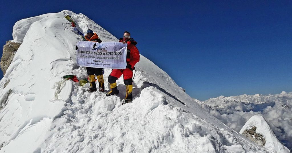
Route: Base Camp (4,850m) → Camp I (5,400m) → Camp II (6,000m) → Camp III (6,300m) → Summit (7,126m) → descend to Base Camp (4,850m)

For the final summit, you will start early and move faster. The summit window is usually short, and the weather can change rapidly. You will leave base camp for Camp I, then follow the route to Camp II and Camp III. Finally, you will ascend to the summit. You will spend only a short time at the top of Himlung due to extreme conditions. Then you will descend the same route you ascended. Usually, the expedition team descends to Camp II or Camp I on the same day. At the end of the rotation, you will descend to base camp.

From Nar Phu Valley to the Summit of Himlung Himal

Above, we explained multiple rotations. Now take a look at the complete breakdown of the Himlung Himal Expedition:

Trekking phase: Koto → Mehta → Phu-Gaon → Himlung Base Camp

First comes the trekking phase, which is also the preparation stage. You will trek through the remote Himalayan landscape and allow your body to adjust to the altitude. The trekking trail starts with a moderate uphill trek along the Marshyangdi River. You will trek through forests of rhododendron and pine. The landscape changes into alpine terrain after Phu-Gaon. It takes you past rocky and snowy sections to Base Camp. During the trekking phase, you will gradually gain altitude while also immersing yourself in the rich culture.

Climbing phase: Himlung Base Camp → High Camps → Summit

From the base camp, the Himlung Himal Expedition enters the climbing phase. In this phase, you will make multiple rotations before finally climbing to the peak’s top. You will climb through moderate snow and moraine slopes from base camp to Camp I. The terrain changes to snowfields and glacial moraines with occasional crevasses from Camp I to Camp II. It becomes more challenging with steep snow slopes, glacier crossings, and high ice and wind exposure from Camp II to Camp III. The last section is from Camp III to the summit. You will climb on long snow ridges, steep slopes, and cross the final fixed rope section. You will descend the same way back to the base camp.

How Has the Popularity of Himlung Himal Expeditions Changed in the Last Decade?

Himlung Himal has become increasingly popular over the years. The peak is still among the hidden Himalayan gems. The Nar-Phu valley, where the mountain is located, was not opened to foreigners until the 1990s. Hence, the mountain only began to attract attention after the restriction was lifted. The valley remains a restricted area, requiring a restricted area permit (RAP) for access. 

Even after the access, the popularity of Himlung Himal was limited. Only a few people had heard about the peak. A Japanese team first successfully ascended Himlung Himal in 1963. They climbed the peak via the northwest ridge. After the successful attempt, only a handful of climbers climbed the mountain in the early 2000s and 2010s. It is still one of the lesser-known expedition mountains, untouched by commercialization and crowds. 

Himlung Himal gained popularity only recently, in the 2020s. It has attracted climbers, but its potential remains to be fully explored. Its remote and restricted location, along with logistical difficulties, make the expedition challenging. Compared to Mera Peak or Island Peak, the number of climbers taking the Himlung Himal Expedition is low. According to recent guides, around 50-80 climbers take part in the expedition each year. 

The national and international interest in Himlung Himal is growing. Thanks to social media and expedition blogs, climbers are showing interest in the peak. Many consider it a practice peak before upgrading to 8,000m. If the trend continues, the mountain may gain further popularity in the future. Steadily but surely and intentionally, the word of Himlung Himal is spreading amongst the mountaineering community.

FAQs 

Our Latest Blog

Attractions, Tips & Activities. Explore Now!

View All Blog

Plan Your Perfect Adventure

Tell us where you want to go and we’ll take care of the rest.
Get a custom travel plan tailored to your interests and schedule.

Start Planning